
Oversight: mission statistics and national consolidation
A ministry today steers its diaspora using reports compiled by hand at each embassy: inconsistent, incomplete, and dated from whenever someone found the time to write them. Here the figures are produced by the system that runs the operations — so they are consistent, complete and permanently current, with nothing to ask of the posts.
National consolidation, read-only
The supervising ministry has its own access, cutting across the network. It reads in real time the nationals enrolled by status — active, pending, suspended, deregistered — cards issued, documents generated, activity over the last thirty days and pending requests, across every mission.
It also sees how many embassies are active, and which are not responding. A console that hides its own outages serves nobody: an unreachable mission is flagged as such rather than counted as zero.
- Nationals enrolled by status, network-wide
- Cards issued and documents generated, in total and per mission
- Pending requests across every mission
- Embassies ranked by numbers enrolled
- World map of the missions
Read-only, and that is an argument
The ministry observes without being able to act on a post's operations. This is not a technical limitation but a choice: each mission's operational sovereignty is preserved, which is the condition for posts to adopt the system rather than work around it.
A post that fears a central service editing its cases keeps a parallel register. That is how centralised systems die.
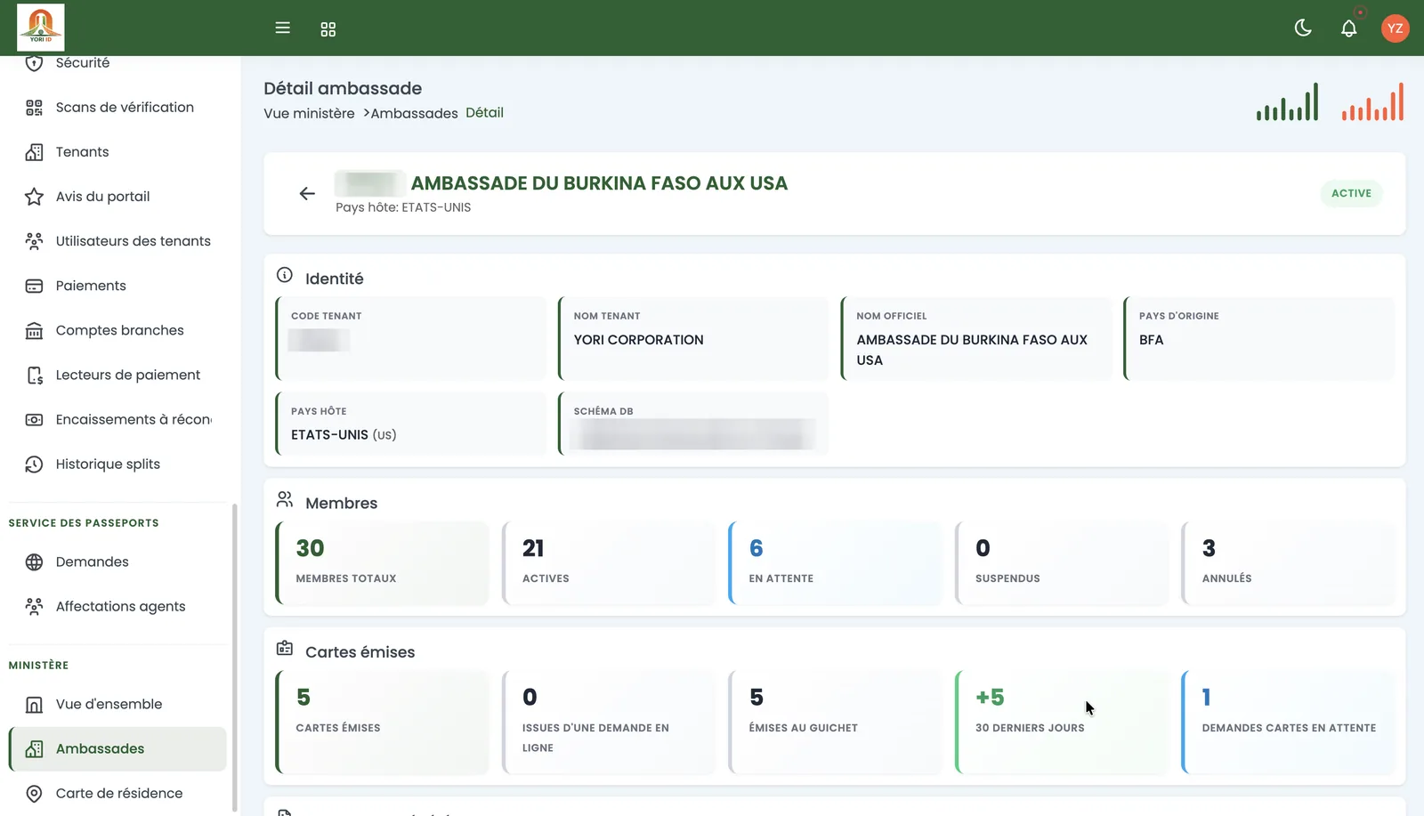
Per-embassy view and digital adoption
For each mission, the ministry reads the host country, numbers enrolled by status, and cards issued — including the share that came through the online channel.
That last measure is the most useful one in a digitalisation programme: it says, mission by mission, whether users are actually moving online or whether the counter remains the norm. It is the indicator most projects lack, and without it there is no telling whether the programme works.
Knowing the diaspora, not just counting it
At mission level as at ambassador level, statistics go beyond headcount: occupations, age pyramid, family structures, rate of association membership.
Geography is handled on two distinct axes — where nationals come from and where they live — with drill-down by zone level and a geolocated map of places of residence. Where a diaspora comes from and where it lives are two different questions, and so are the policies that follow.
The annual report in one export
Member statistics export to a five-tab workbook — summary, geography, breakdown by sex, occupations, age — in the mission's own colours.
It is the report each post writes by hand today, once a year, in a format matching no other post's.
- Monthly trends in services delivered
- Processing times by request type
- Card renewal rates
- Operational alerts: cases pending, cards expiring within thirty days
Why bespoke development cannot do this
These analyses do not exist because a statistics module was bolted on: they exist because the platform is multi-mission by design, on a single data model.
Software written for one embassy, then rewritten for the next, structurally cannot produce national consolidation: it produces N reports to reconcile by hand, which is precisely the original problem.
Frequently asked questions
Can the ministry edit a mission's cases?
No. Its access is read-only and cuts across the network. It observes activity without being able to intervene in a post's operations, which preserves each mission's operational sovereignty.
Are the figures current?
They are produced by the system that runs the operations, so in real time. There is no periodic return to request from the posts, and no compilation delay.
Can digital adoption be measured?
Yes, mission by mission: an embassy's view shows the share of cards issued through the online channel. That is the indicator that tells you whether a digitalisation programme is having its effect.
Can statistics be exported?
Member statistics export to a five-tab workbook in the mission's own colours — summary, geography, sex, occupations, age.